


Three floods in two months, 3 people died, more than 3,000 people were displaced when flood waters...
With the northeast monsoon hitting Malaysia in force, residents of Kampung Iboi and surrounding villages near Baling, Kedah brace for more floods.
Since the fatal floods there last July, the villages have been inundated several times more.
Villagers are adamant that the cause of the recurring floods is the durian plantation on top of Gunung Inas, next door.
The month after the first major floods, they took Malaysiakini on an eight-hour hike up the mountain to show the extent of the damage.
This is what we saw.

As a nonprofit journalism organization, we depend on your support to fund more than 170 reporting projects every year on critical global and local issues. Donate any amount today to become a Pulitzer Center Champion and receive exclusive benefits!
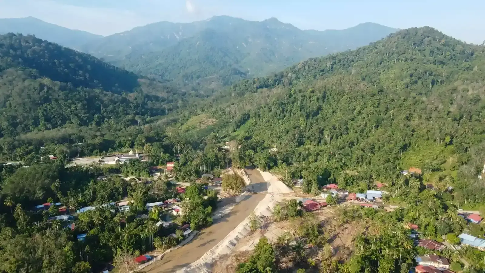
Kampung Iboi is located 75m above sea level, next to Gunung Inas Forest Reserve, downstream of Sungai Kupang.
Gunung Inas has an elevation of 1181m above sea level. The plantation is located some 700m above sea level.
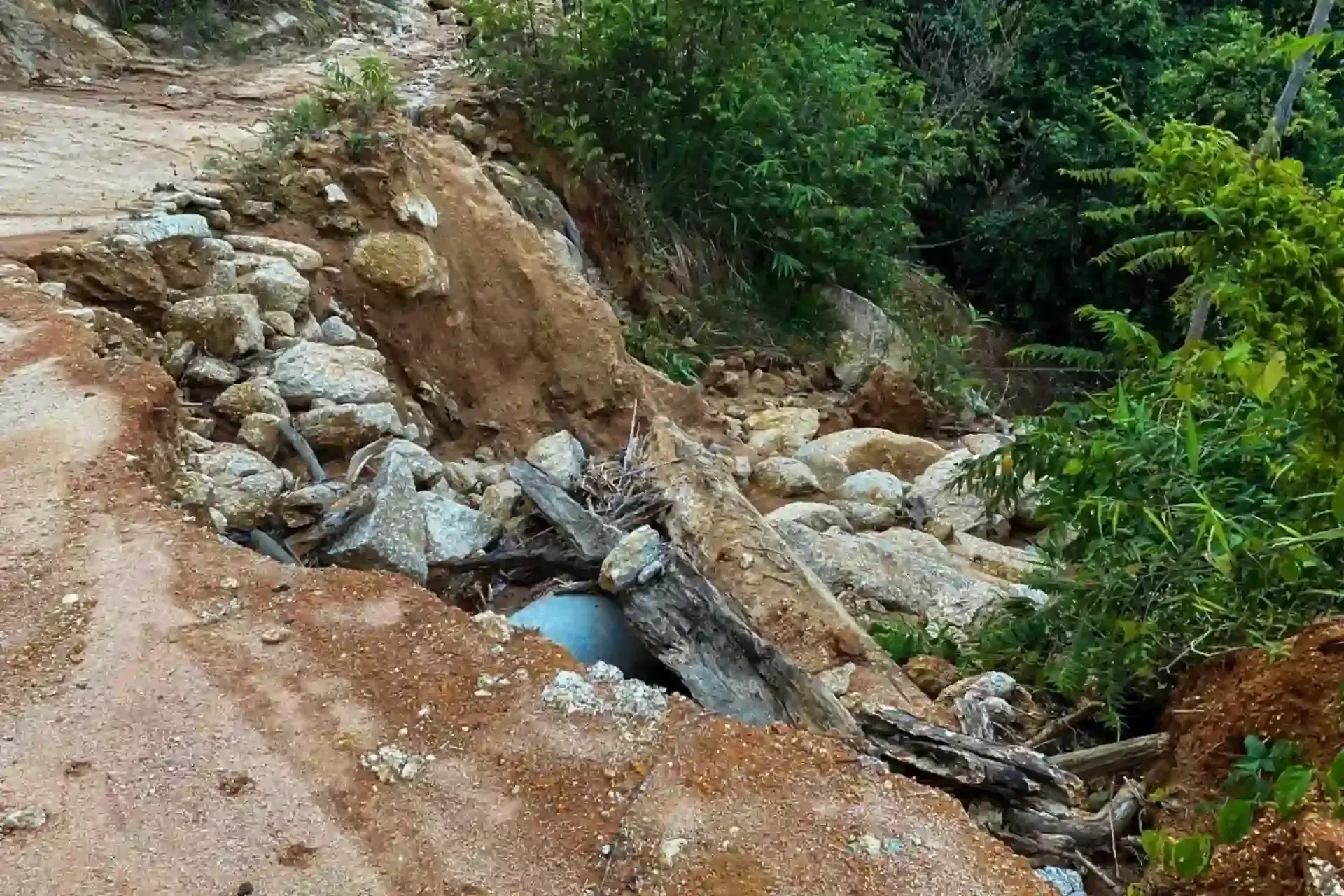
From the village, only part of the way is accessible by motored vehicle.
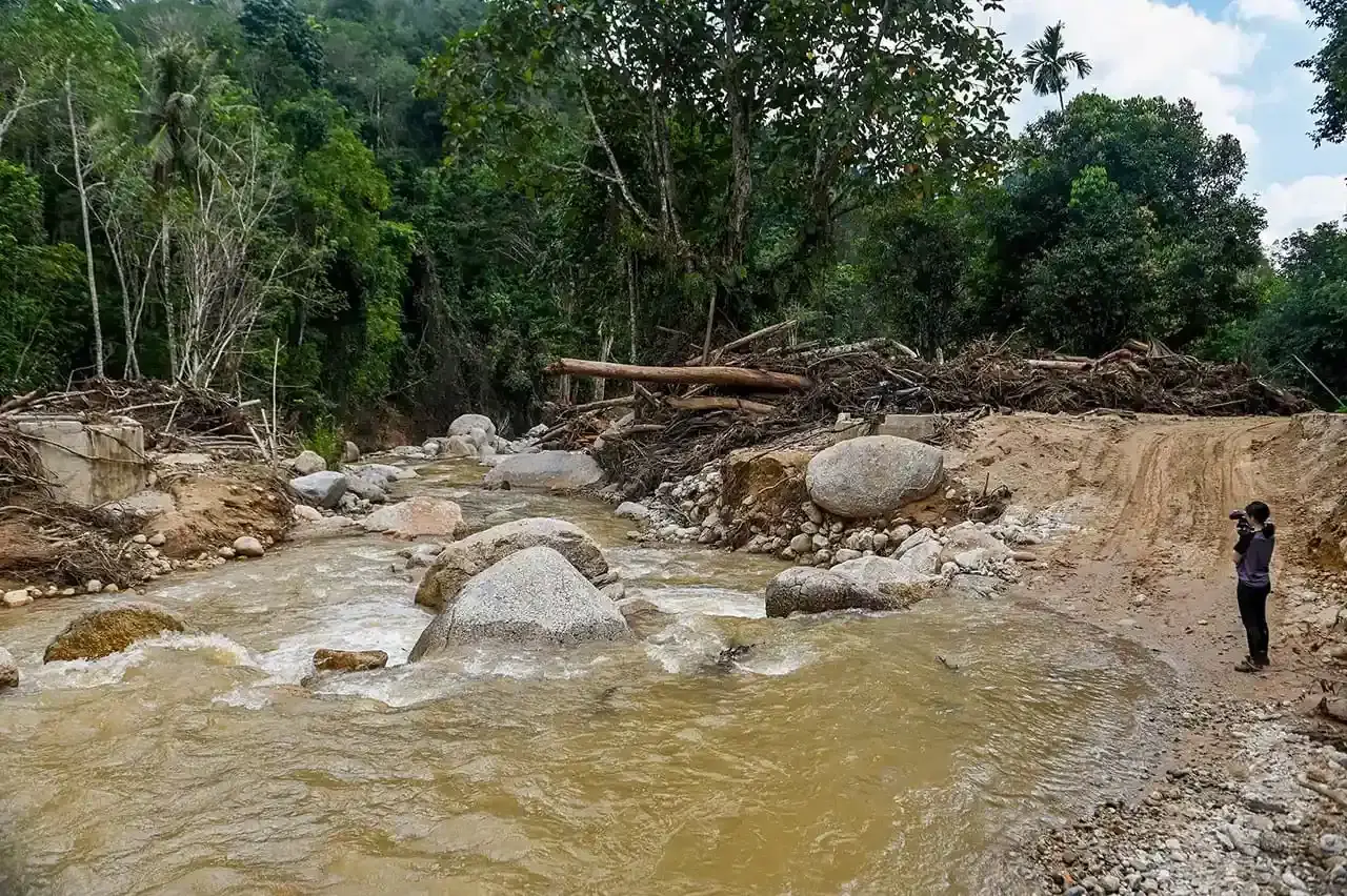
Riding on the back of motorcycles, at about 280m above sea level, Malaysiakini observed a rubber plantation and Sungai Kupang clogged by logs and branches which had washed downstream.
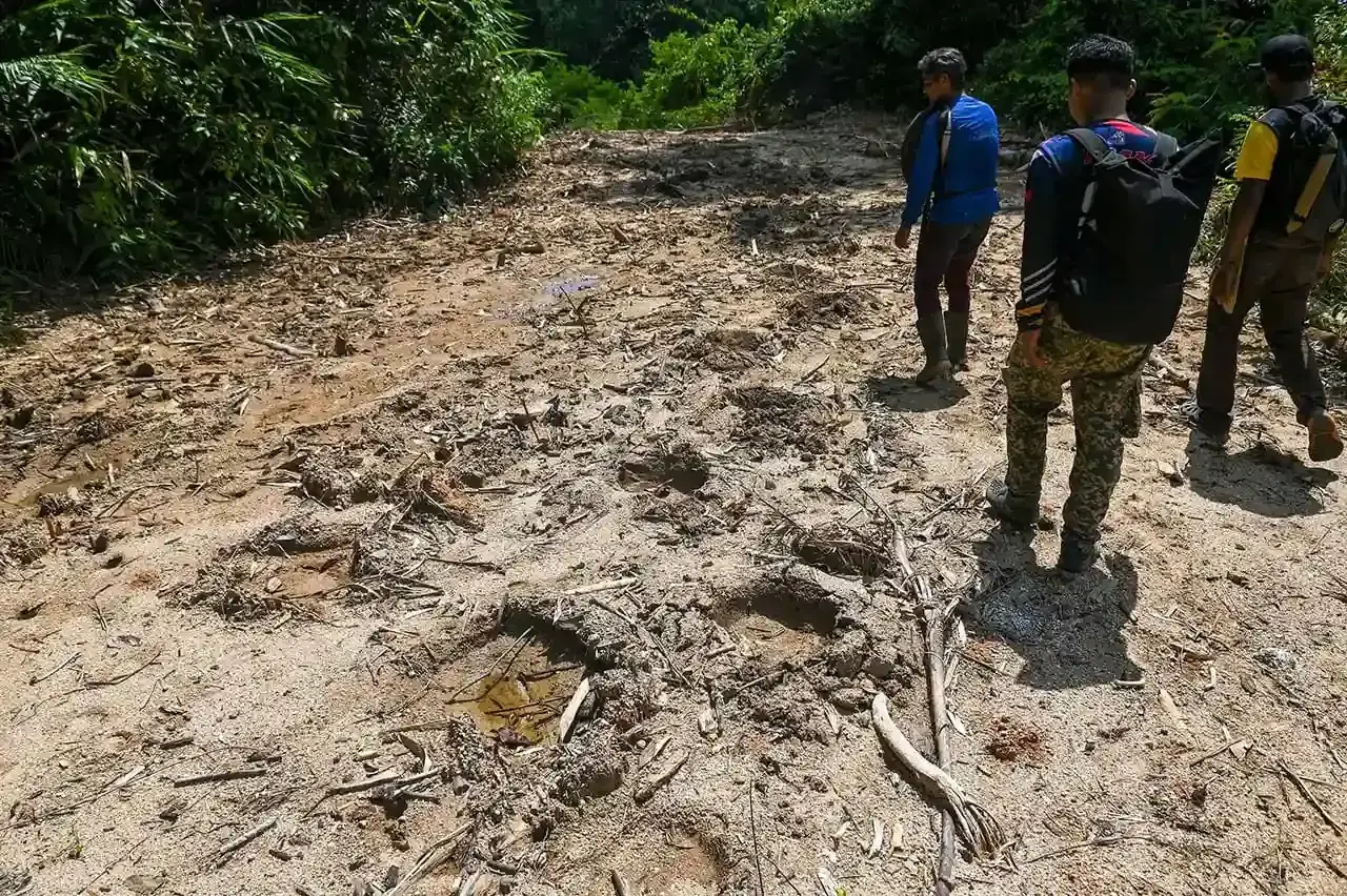
After 330m above sea level, the rest of the journey must be completed by foot.
At this point, elephant footprints were spotted, indicating that this forest reserve is the endangered species' habitat.
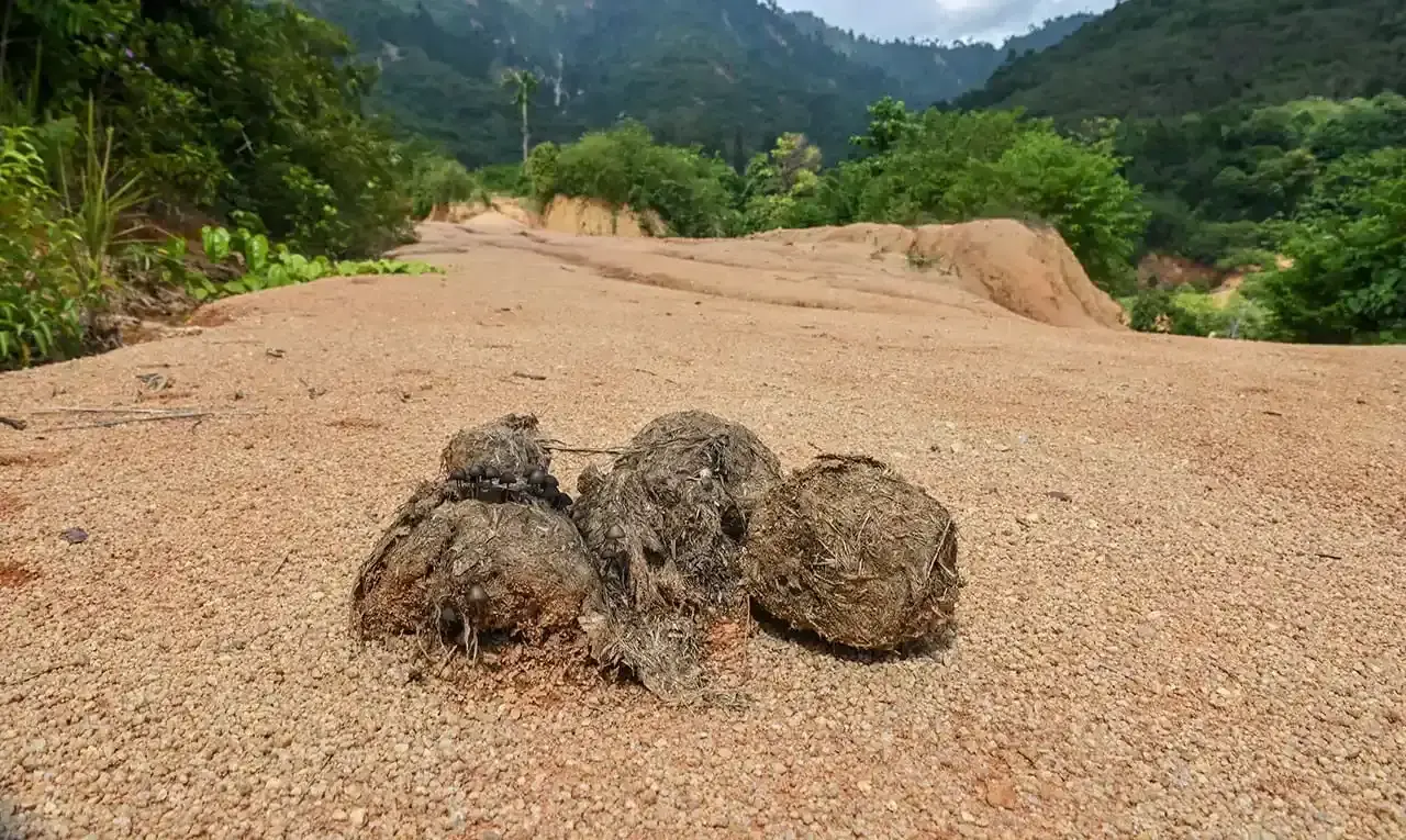
Elephant dung was also spotted on the hike. There are less than 1,100 elephants in the wild in Peninsular Malaysia.
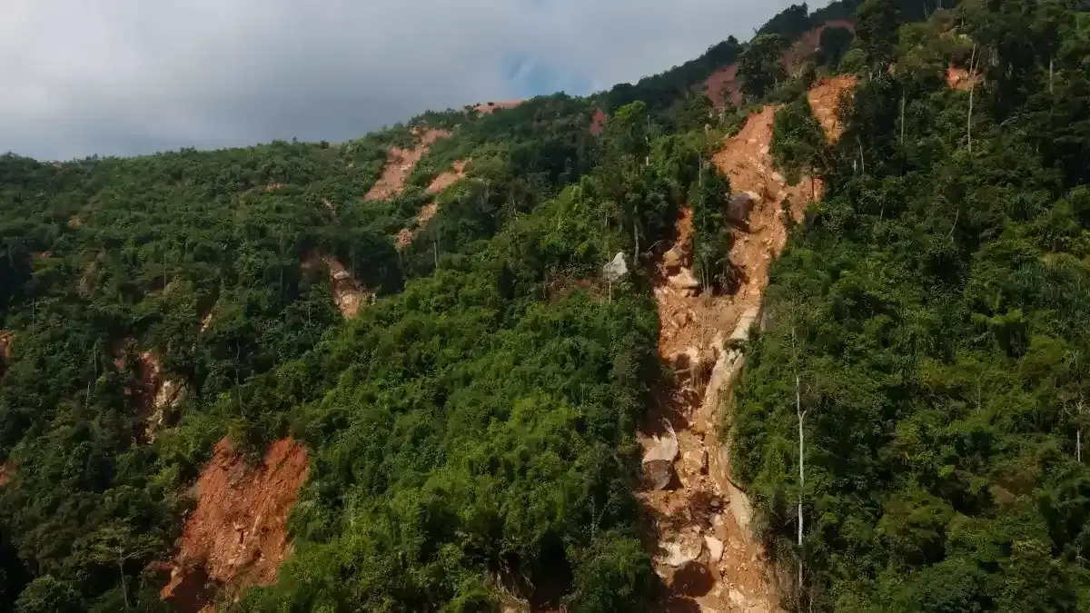
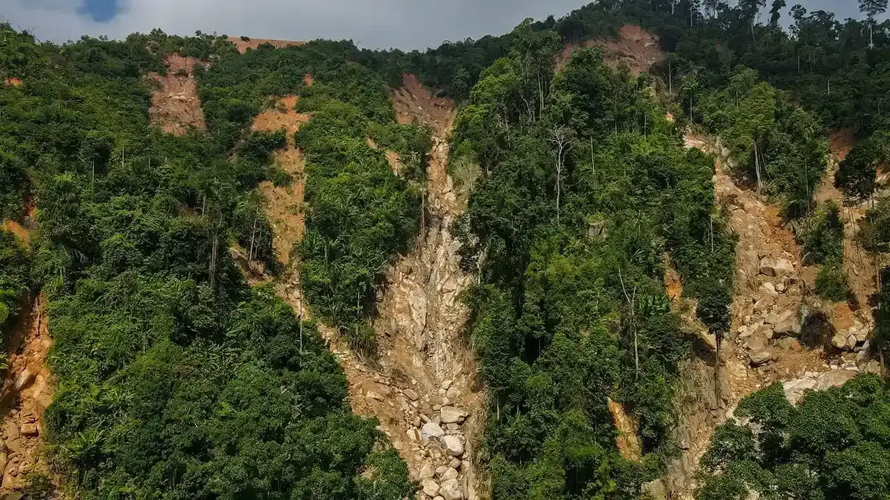
This was the condition going up the mountain, at about 330 to 700m above sea level.
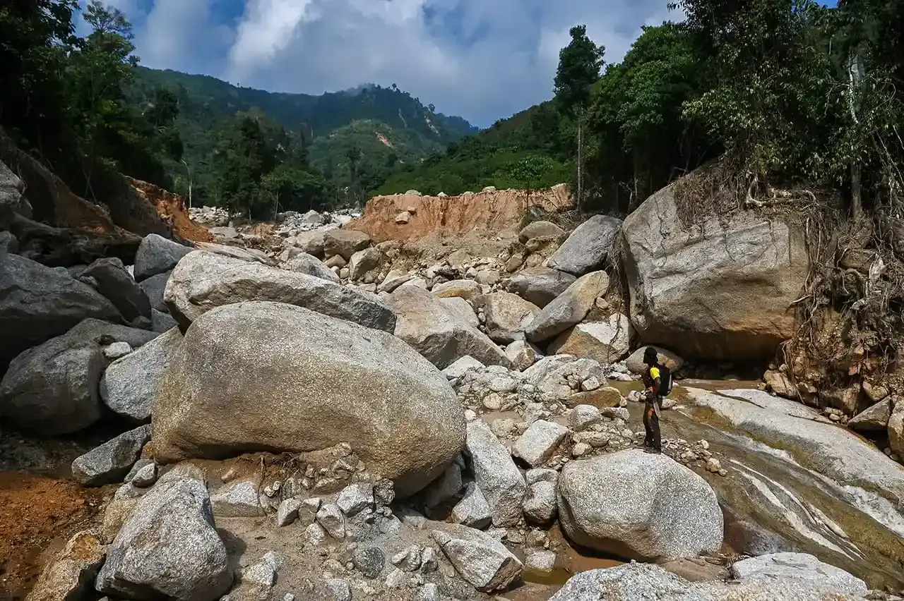
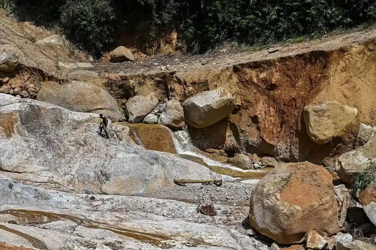
A month after the fatal floods, the mountain side was bare and covered by rock fall and large boulders.
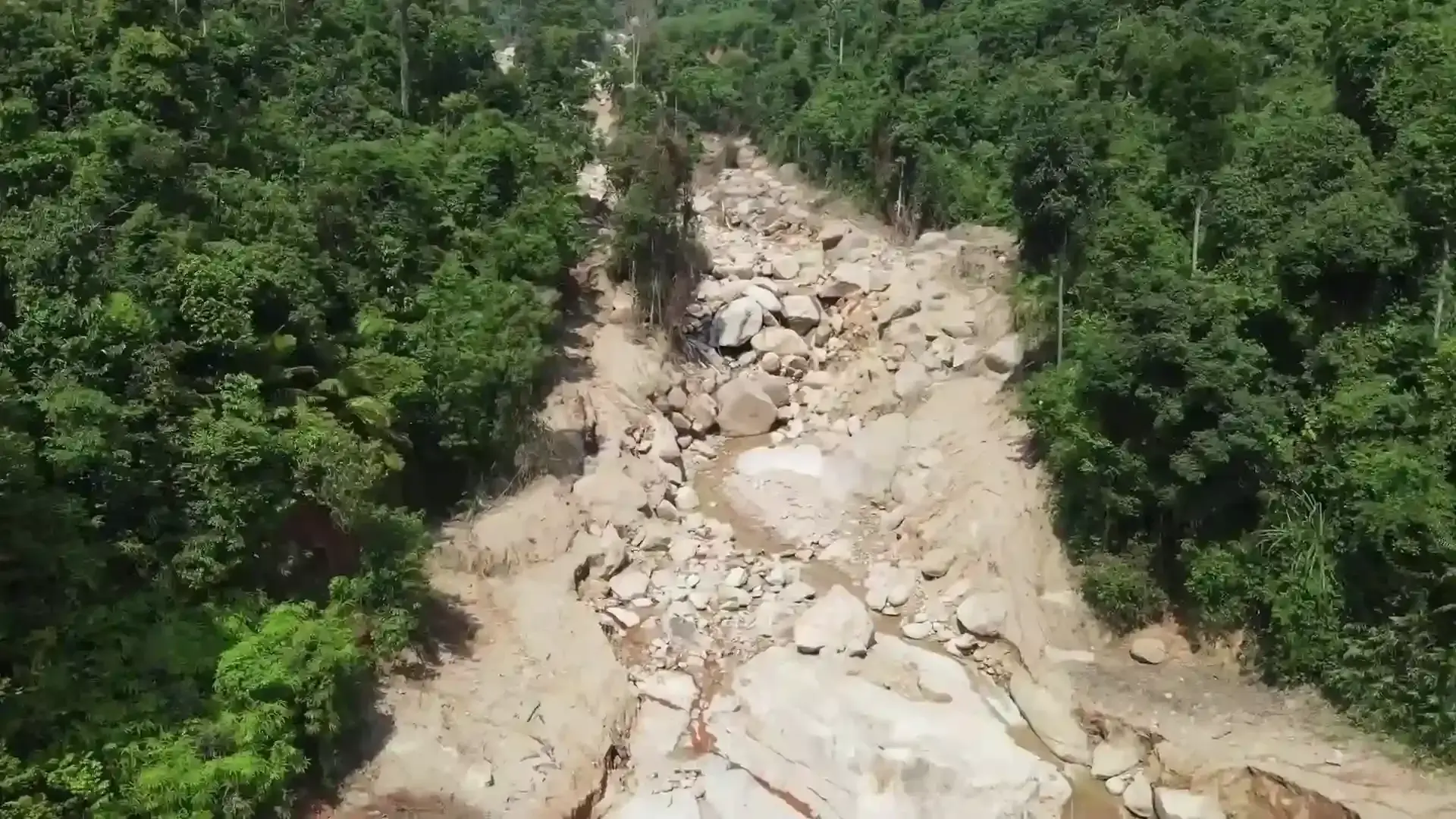
There were also signs of slope slumps, rock fall and debris flow.
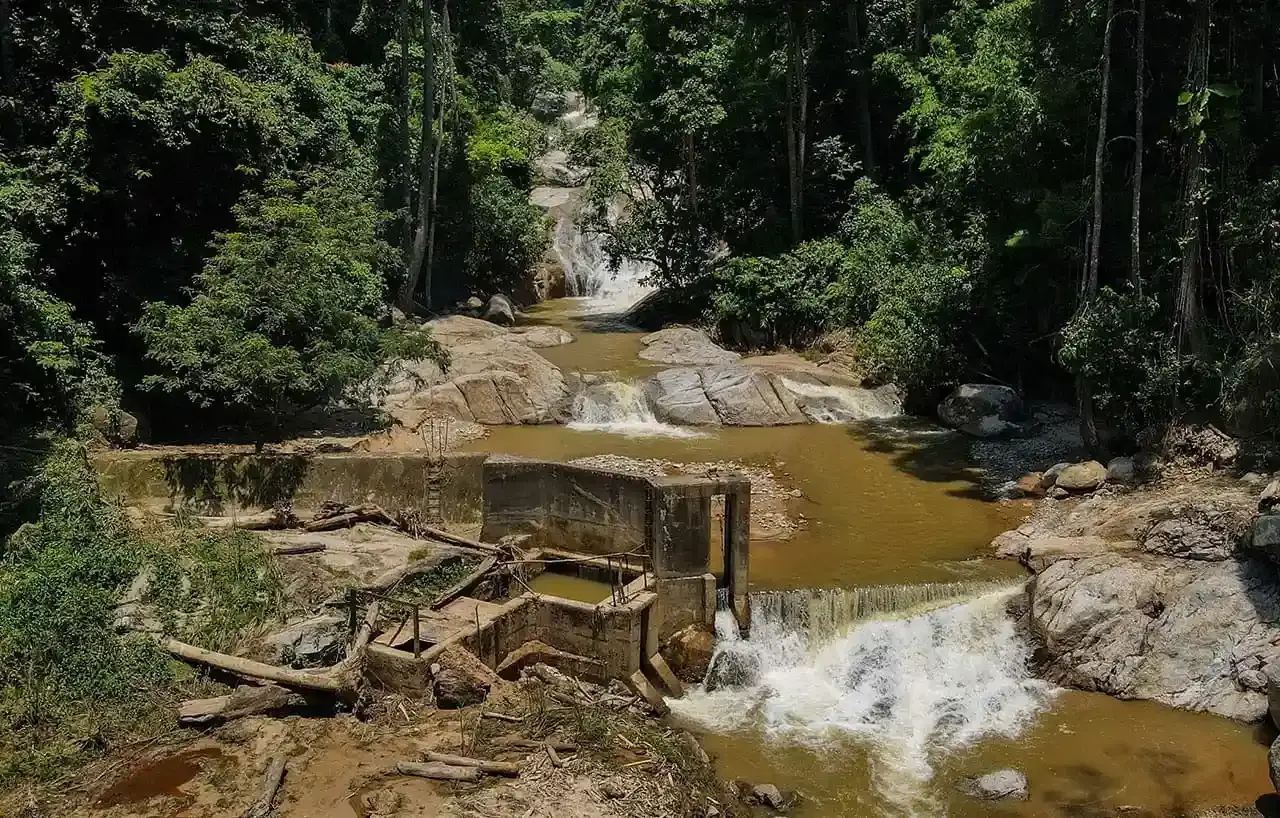
Villagers said a stream used to flow rapidly in these parts. But to facilitate monocrop plantation projects up the mountain, the stream was redirected and water pumped uphill, they say.
Here, villager Azhar Md Isa shows how the stream was redirected. This is one of the smaller ponds built lower on the mountain. It survived the floods.
But around the pond are signs of damage in the form of uprooted trees, slope slumps and landslides.
To allow heavy machinery to be moved up, planters cut terraces on the side of the mountain, they said. The terraces are supported by wood.
Some of them, the villagers said, gave way in the floods, adding to the dirt and debris that hit the villages downstream.
The hike was challenging but villagers are used to it.
For decades, they had sourced water from catchment ponds they built on the mountainside.
In the aftermath of the floods, some quarters said these ponds contributed to the floods.
But here, villager Mohamad Nor Maslan Aziz shows how their ponds are still intact. Instead, villagers blame catchment ponds built by the planters.
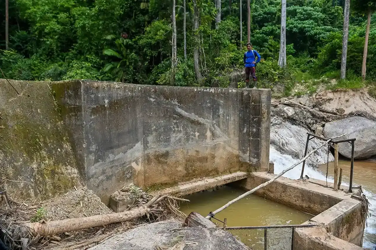
Water from the streams was mostly redirected to those mega catchment ponds up the mountain.
The villagers believe the ponds gave way, leading to the flooding.
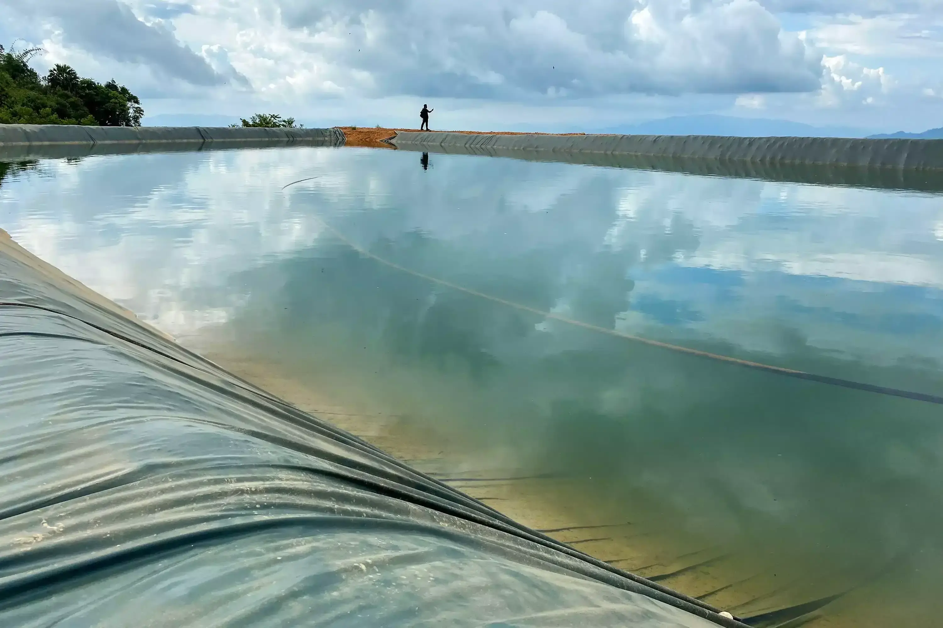
The villagers said there are three large ponds at the top of the mountain. These ponds are larger than Olympic-sized swimming pools.
The villagers’ theory is the ponds gave way during heavy rain, causing the flooding downstream.
Actually, the authorities said one pond did give way. But Universiti Malaya expert Professor Azizan Abu Samah says it is unlikely the cause of the flooding.
He said the pond did not contain enough water to cause such damage.
He said the release of water from dams, like in Semenyih and Pedu, have previously resulted in tremendous headwater and downstream flooding, but this is unlikely in the case of relatively smaller irrigation ponds.
The headwater on July 4, he said, is likely natural, but this doesn't mean the tragedy was not caused by humans.
How big are the irrigation ponds on Gunung Inas?
Here, Azhar helps us measure the size of one irrigation pond. By his measure, the pond holds an estimated 8 million litres of water. The Semenyih Dam has a capacity of 59,071 million litres.
It didn’t happen overnight
The geological report on the fatal floods said unusually high rainfall at the top of the mountain is partly to blame for the disaster.
But Professor Azizan doubts this, arguing that data from two global precipitation networks - Nullschool and NASA - showed no such unusual rainfall and that the area only received less than 3 mm of rain per hour within three hours.
The rain that fell in the Kupang area, where the disaster took place, was twenty times less than the rain that fell on Bentong during a similarly devastating flood there on Dec 17, 2021.
Instead of one event of heavy rainfall, or irrigation ponds giving way, Professor Azizan believes the disaster was caused by poor slope management after massive forest clearing, over a period of several years.
Clearing in high risk areas
In fact, the Department of Environment (DOE) never approved the Musang King durian mega plantation.
In 2013, the approval was granted to clear all logs to turn the area into a timber latex clone rubber plantation.
But the DOE advised against clearing several "high risk" areas in the compartment, including slopes with gradients of steeper than 25 degrees.

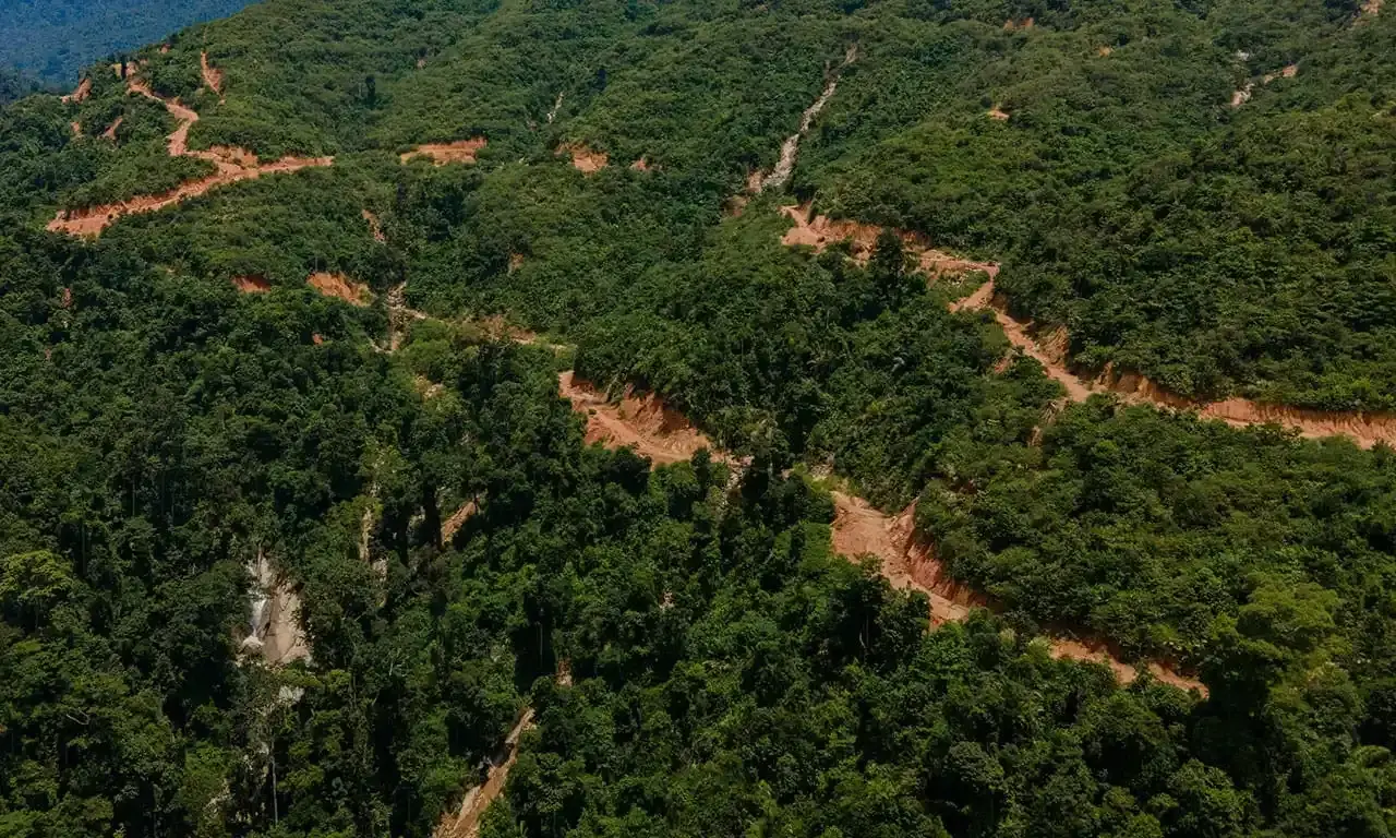
Even so, satellite imagery from 2017 to 2020 showed much of those "high risk" areas had been cleared.
The DOE said a stop-work order was issued to the durian plantation when it was discovered, following complaints of smaller floods by local residents.
There has been no active logging or plantation works at the site since 2020.
In a twist of irony, durian cultivation experts are scratching their heads on why anyone would want to plant durian on such an incline, in such conditions.
On the hike, durian saplings were spotted at 700m to 850m above sea level.
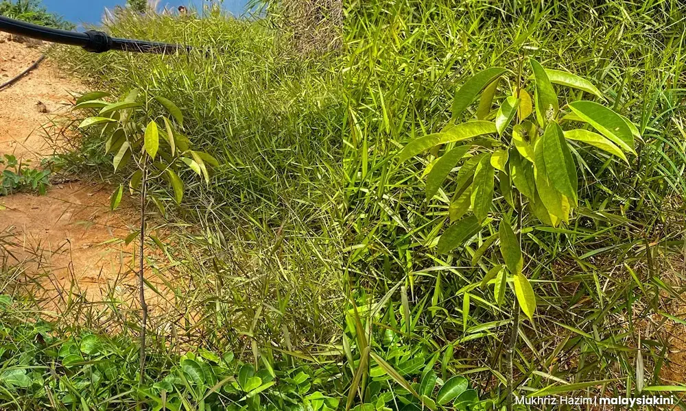
When shown pictures from our trek, durian expert, Lim Chin Khee, said such an elevated area is unsuitable for durian cultivation.
He said after 800m above sea level, durian trees are unable to blossom, while at anything higher than 600m, the durian flesh would be too pale, the Agriculture Ministry expert said.
So why did the state choose to plant durian on this mountain? Faced with bare slopes in 2018, then Kedah MB Ahmad Bashah Md Hanipah said he approved it as it was the best option at the time, after massive clearing in previous administrations.
Compartment 8 was initially cleared in 2012 under the MB Azizan Abdul Razak, as part of the poverty alleviation rubber plantation project called Ladang Sejahtera.
But by the time Mukhriz Mahathir took over as MB in May 2013, much of the land was still bare. He said he ordered terracing work to manage the bare slopes but there were management issues, leading to 2016, when Ahmad Bashah took over.
An ever-present deadly risk
Durian or rubber, ultimately it is the failure to manage large scale deforestation on hilly terrain, which finally came to a head and claimed lives on July 4.

The flood cost RM28 million in losses and four lives, but the story did not end there.

This is a video of flooding in Kampung Iboi in September.
Since July, Kampung Iboi residents have faced at least 11 incidents of severe flooding.
"The residents are tired and traumatised by the recurring floods. I really hope the authorities can do something as soon as possible to help the villagers."
Nor Mohamed Che Hussain, Kampung Iboi village chief, after another round of flooding on Dec 1, 2022
In fact, in the geological report of the July 4 flood, experts proposed villagers living in the high risk flood zones to be evacuated for an extended period.
Professor Azizan said the best thing to keep the slope stable is a forest but it would take several decades more for nature to recover from the massive clearing.
Until then, the deadly risk to Kampung Iboi residents and neighbouring villagers is ever present.
"The slope is there, it’s already cleared, which means the slope is unstable. The chances of a landslide are already there. So when you have heavy rainfall, the people of Kampung Iboi would be affected. And they already are."
Azizan Abu Samah. Professor at Universiti Malaya’s Institute of Earth and Ocean Sciences