


Ecuador does not have updated and reliable information on extractive activities, and the pandemic has aggravated the information gaps on this issue. The official mining map, prepared by government entities, has been slow to be fully disseminated, is not updated, and shows many inconsistencies. Several organizations at national level have denounced that the information disseminated by the Ecuadorian state institutions tends to modify the location of protected areas or inhabited regions to favor extractive activity, whether mining, oil or agro-industrial, and the health emergency has plunged the Amazonian populations into state neglect.
In 2013, the journalists involved in this project published a report showing how official maps "erased" traditional communities who were in voluntary isolation to justify the layout of oil fields, which resulted in the exploration and exploitation within the Yasuní National Park, arbitrarily extending the extractive frontier by order of the government of the time, actions that continue to this day.
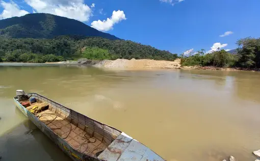
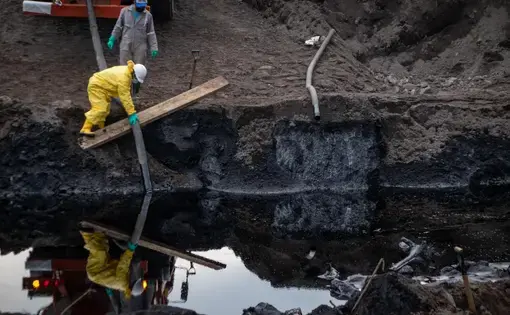
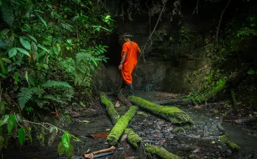
Therefore, The Map of Death seeks to offer a visual understanding of the destruction registered in the Ecuadorian Amazon and its progress during the pandemic, detailing the effects on forests, watersheds, human populations displaced or threatened by erosion or by the installation of extractive plants and other impacts that do not appear in official documents.
The Map of Death is a work of cartographic journalism that will make it possible to contrast — by superimposing images — the version contained in the official maps with the firsthand information gathered in the affected territory. The visual cartographic material will be designed and staged on a microsite created for this purpose, guaranteeing navigability and usability, along with an enhancement of the informative quality of the journalistic content and its permanent updating.